Deze vertaling is ouder dan de originele pagina en kan verouderd zijn. Kijk wat er is veranderd.
Vertaling van deze pagina?:
Dit is een oude revisie van het document!
 Deze pagina is nog niet volledig vertaald. Help alsjeblieft de vertaling compleet te maken.
(verwijder deze paragraaf als de vertaling is voltooid)
Deze pagina beschrijft de informatie op en de functies van het c:Geo hoofdscherm.
In de volgende tabel worden de hoofdmenu pictogrammen beschreven:
| Icoon | Functie | Omschrijving |
|---|---|---|
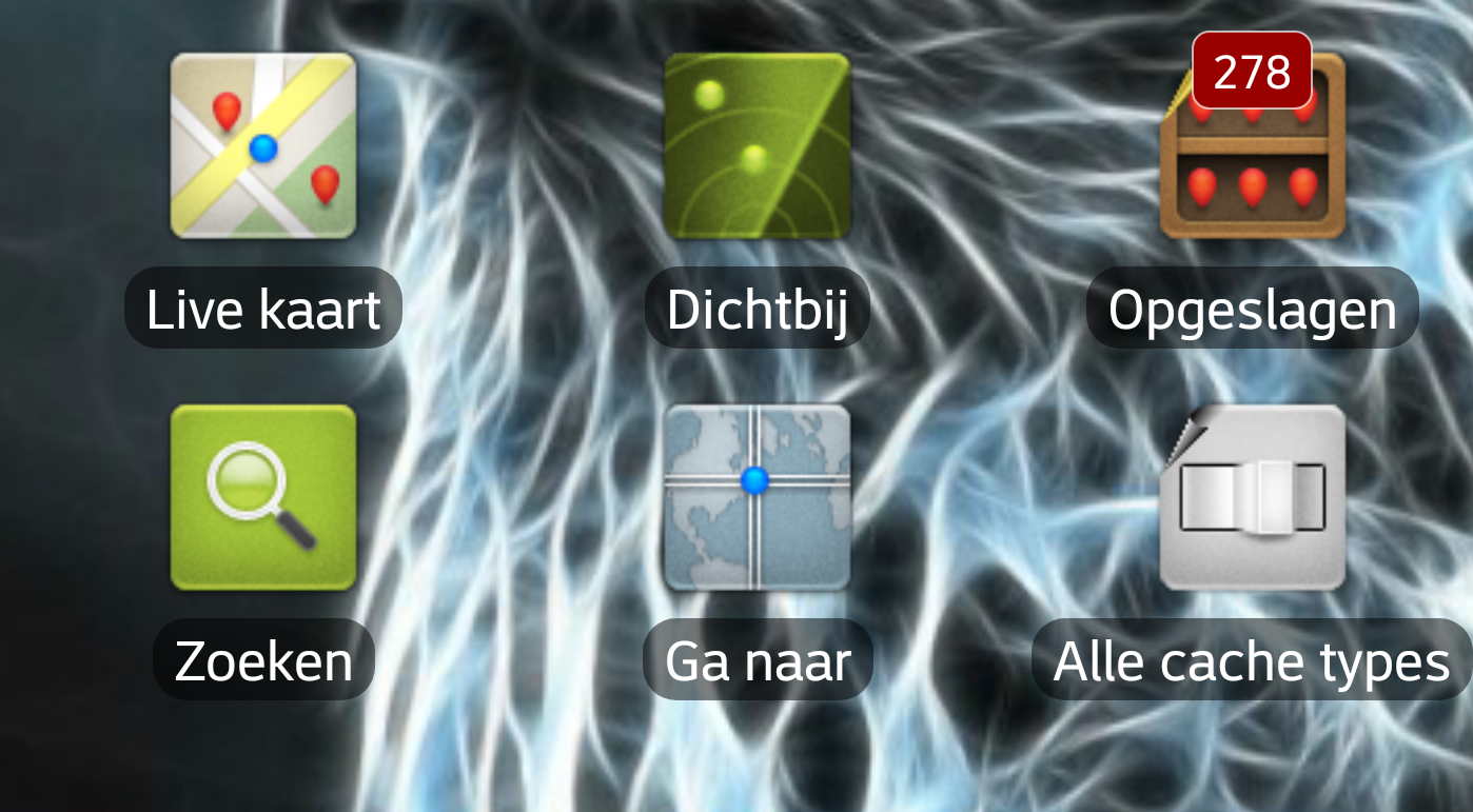
 | Live kaart | Toon een kaart gecentreerd op je huidige locatie met nabijgelegen geocaches erop. Je kunt de kaart slepen om geocaches op andere locaties te bekijken. Als je de kaart met de nieuwste geocachelocaties wilt bekijken, heb je online toegang tot het netwerk nodig. De weergegeven geocaches kunnen worden gefilterd met behulp van het Global Cache Type Filter (zie hieronder). |
  | Dichtbij | Maak een lijst van de nabijgelegen geocaches. In tegenstelling tot de livekaart, maakt deze functie een online query op basis van je huidige locatie, zoals verkregen door GPS of van het netwerk. De vraag wordt niet automatisch bijgewerkt wanneer je verplaatst. Om deze functie te gebruiken, heb je online-netwerktoegang nodig. Alsje geen geldig GPS-signaal of andere locatiegegevens hebt, is dit pictogram uitgeschakeld. |
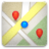
 | Opgeslagen | Bekijk geocaches die je hebt opgeslagen voor offline gebruik. Je kunt ook opgeslagen geocaches gebruiken voor online caching, als een takenlijst. Door geocachegegevens op te slaan, kun je onnodig gebruik van netwerkbandbreedte en vertragingen voorkomen. Het totale aantal opgeslagen geocaches wordt weergegeven in de rechterbovenhoek van het pictogram. Als je je opgeslagen geocaches in lijsten hebt georganiseerd, kun je lang op het pictogram drukken om rechtstreeks naar een specifieke lijst te gaan. |
 | Zoeken | Zoek naar geocaches op trefwoord, geocode-identificatie, adres, gebruikersnaam, etc. |
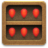
 | Ga naar | Navigeer naar een willekeurige locatie met behulp van het kompas, de radar, stap voor stap navigatie of een andere ondersteunde navigatiemethode. |
 | Alle cache types | Filter de geocaches die worden getoond op de livekaart, zoekactie en je opgeslagen geocachelijsten op geocachetype. Je kunt ervoor kiezen om alle geocaches te zien, of alleen die van een specifiek type. De tekst onder het pictogram geeft het momenteel actieve filter aan. Om het filter leeg te maken, druk je lang op het pictogram. |
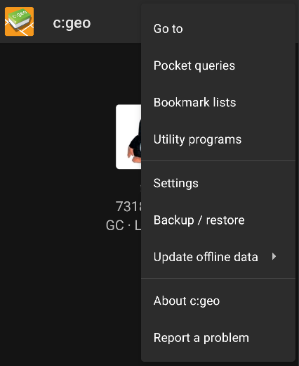
The top section of the main screen contains additional functions either shown as an icon in the top bar or hidden behind the overflow menu button (three-dot button). The available functions are described below.
The number of icons you see in the top bar is determined dynamically, based on your device resolution and screen orientation. The remaining top bar items are behind the overflow menu button.
To see the name of an icon in the top bar, long-press the icon.
| Icon | Function | Description |
|---|---|---|
| Quick search | If you are offline, search your stored geocaches using title, geocode, description, owner, log content, etc. If you have network access, search both stored and online content. You can input a geocode, trackable code, username, and much more. |
|
| History | View a list of geocaches you have recently logged with c:geo. Note: The list is local to c:geo and is not synchronized with the recently viewed caches list on the geocaching website. |
|
| Overflow menu button | Open the overflow list of top bar functions that, based on your screen size, do not appear as icons. The functions include those described in this table. | |
| Pocket Queries | Open a list of your pocket queries from geocaching.com. This item is not available for geocaching.com basic members. | |
| Settings | Open the c:geo configuration menu. | |
| Backup | Launch the settings backup function, which can be also found in the c:geo Settings. | |
| Utility programs | Open a list of links to additional geocaching-related apps, which can be useful in conjunction with c:geo. | |
| Scan Geocode | If a barcode scanner app is installed on your device, launch it and scan barcodes that contain geocodes. | |
| Invite friends | This function has been removed. | |
| About c:geo | View c:geo version information, contributors, contact links and other nice-to-know things about c:geo. |
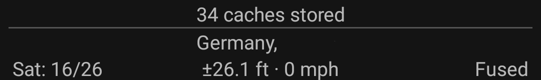
The bottom section of the main screen shows information about your login status, your current location, and satellite reception status.
The upper part of the bottom section displays your login status for each Geocaching Service you have configured and enabled in the c:geo Settings, with each service on its own row.
In the above example, the user My username is successfully logged in to geocaching.com (GC) and opencaching.de (OC.DE). The figure shown after the username is the user's current find count on the respective geocaching platform.
Below the login status information is your current location. It is shown as coordinates, or if the Show address setting is enabled, as country and city/region.
In the above example, the user is located in USA, New York
The bottom row in this section shows you the current satellite reception status. As an example, the table below uses the information from the picture above:
| Status | Description |
|---|---|
| Sat: 5/22 | The satellite receiver on the device has found 22 satellites in total and the signal has been fixed to 5 of them. |
| +- 4,65 m | The current positioning accuracy is 4,65 meters. Depending on your app settings, this can be shown in feet. |
| 0 km/h | The current speed is 0 km/h. Depending on your app settings, this can be shown in ft/h. |
| Last known | The currently-used location source: Last known = Last known position acquired by c:geo Home = Home coordinates as defined on geocaching.com GPS = Provided by GPS receiver Network = Derived from mobile network information Fused = Determined using both Google Play Services and GPS receiver |
