Deze vertaling is ouder dan de originele pagina en kan verouderd zijn. Kijk wat er is veranderd.
Vertaling van deze pagina?:
Dit is een oude revisie van het document!
 Deze pagina is nog niet volledig vertaald. Help alsjeblieft de vertaling compleet te maken.
(verwijder deze paragraaf als de vertaling is voltooid)
The compass is the built-in navigation tools in c:geo. You can start the compass from the cache detail page for the cache coordinates itself or for any waypoints of a cache.
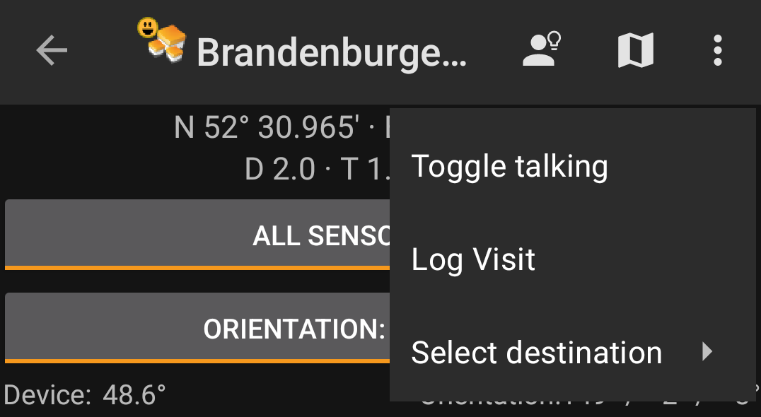
The top section of the compass contains additional functions either shown as an icon in the top bar or hidden behind the so called overflow menu button (three-dot button). All available functions are described below.
The icons shown in the top bar and the contents behind the overflow menu button are distributed dynamically based on your device resolution and screen orientation. Thus it might be possible, that more or less items can be found behind the menu button or instead shown as icons in the top bar on your device.
In case a menu entry is shown as an icon you can long press the icon to get a popup showing its function.
| Icon | Function | Description |
|---|---|---|
 | Hint | This will show a small popup window on the compass showing the cache hint (if provided by the owner) |
| Show on map | Will open the target coordinates on the map. | |
| Overflow menu button | Clicking here will open the menu of functions not fitting into the top bar on your device, thus being displayed as a list instead. The function shown in this list are also described in this table. | |
| Start talking | Will start the text-to-speech output of direction and distance towards the target. You can also switch off the display once talking function has been started. |
|
| Log Visit | Opens the logging screen for cache. | |
| Select Destination | Allows you to switch the compass target between the available waypoints of the cache. |
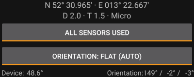
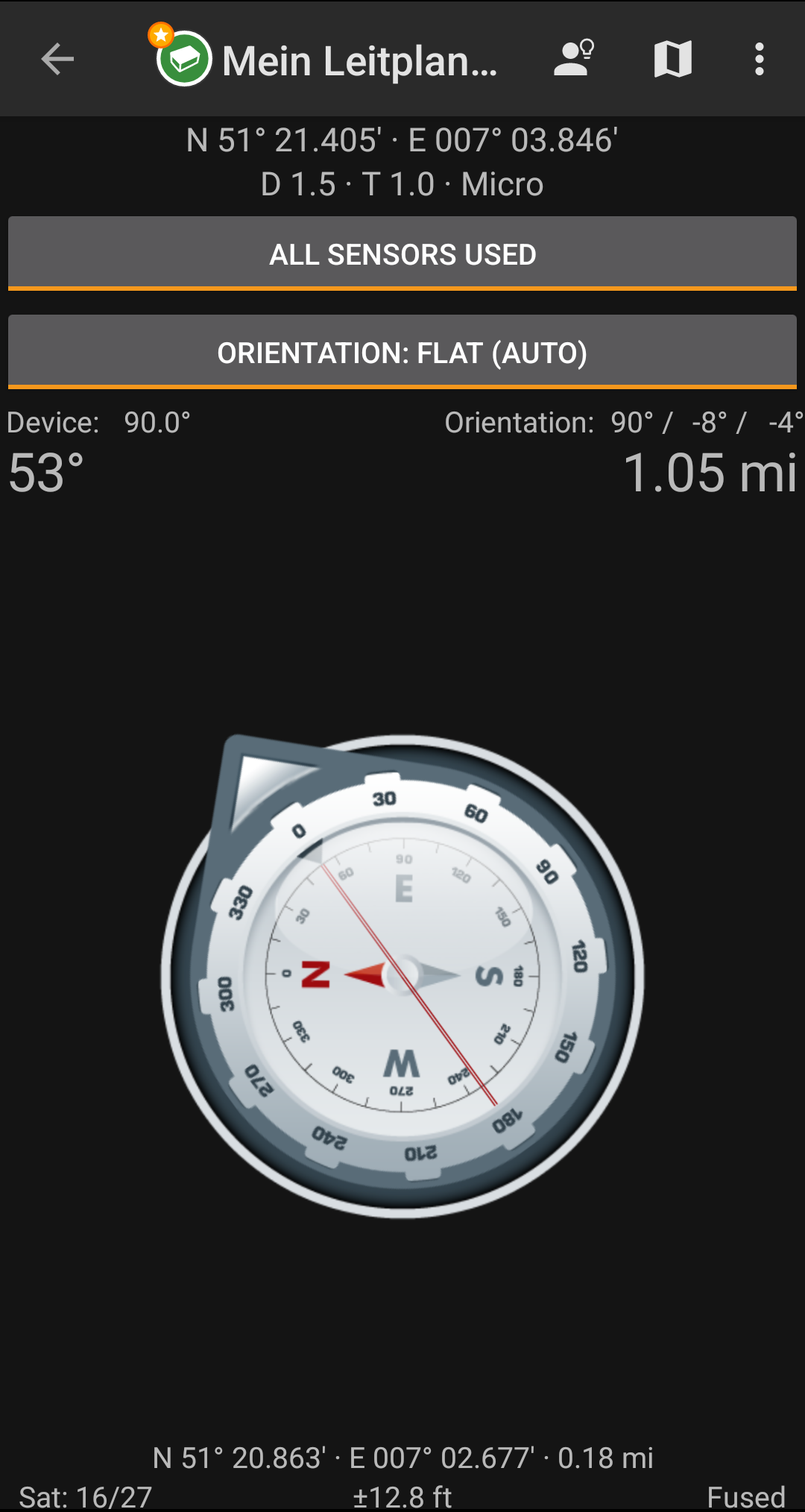
The top section of the compass screen shows the target coordinates and the D/T-rating and size information of the cache.
The button shown below can be clicked to toggle between GPS and Magnetic compass used and GPS only used. Disabling of the magnetic compass will instead use the change of the GPS position to estimate the direction of your movement. This feature is not as precise as the magnetic compass but can be useful if you e.g. use the talking compass and want to store your phone in your pocket (no longer pointing into the walking direction).
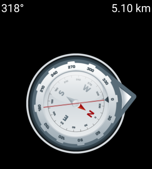
De bovenste regel toont de peiling naar het noorden en de afstand tot je doelcoördinaten. De afstand wordt mogelijk getoon in mijlen (mi) of kilometers (km) afhankelijk van je keuze in de instellingen.
De kompas roos toont je de oriëntatie van het halfrond in zijn binnenste cirkel en de richting naar het doel met de combinatie van een rode lijn en aan de buitenkant een pijl die naar het doel wijst.
De kompasroos zal roteren overeenkomstig de richting van je apparaat, dus altijd wijzend naar je navigatiedoel.
De onderste sectie van het kompas toont je huidige coördinaten en een aantal statussen met betrekking tot je huidige GPS signaal kwaliteit en nauwkeurigheid. Zie de uitleg over het hoofdscherm voor meer details.
