Deze vertaling is ouder dan de originele pagina en kan verouderd zijn. Kijk wat er is veranderd.
Vertaling van deze pagina?:
Dit is een oude revisie van het document!
 Deze pagina is nog niet volledig vertaald. Help alsjeblieft de vertaling compleet te maken.
(verwijder deze paragraaf als de vertaling is voltooid)
BRouter is een kleine app voor Android dat genavigeerde routes aanbiedt welke offline zijn gecalculeerd tussen twee coördinaten, gebaseerd op OpenStreetMap data.
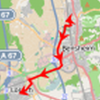
Als Brouter is geïnstalleerd en is geconfigureerd op je apparaat zal c:geo deze gebruiken en in plaats van de normale rechte lijn op een kaart een gerouteerfe lijn tonen tussen je positie en het doel (bijv. een cache of een waypoint). Zoals je kunt zien in de onderstaande afbeelding.
| Navigatie zonder BRouter | Navigatie met BRouter |
|---|---|
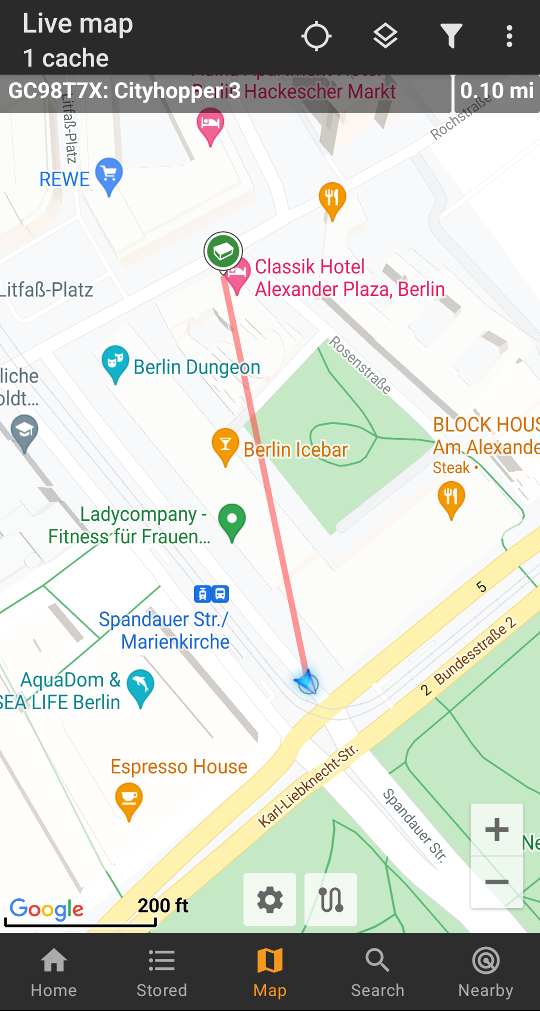 |  |
De route kan worden geconfigureerd om geschikt te zijn voor wandelen, fietsen of auto volgens je behoeften en zal helpen om je weg naar de bestemming te vinden. Daarnaast kun je deze routering ook gebruiken om individuele routes te maken met verschillende waypoints achter elkaar om je caching-reis te plannen.
You can download and install BRouter either from Google Play or directly from their website.
After Brouter is installed you need to download routing information for the desired geographical area for BRouter to be able to offline calculate routes. Without this downloaded routing information BRouter will not work (no online routing supported).
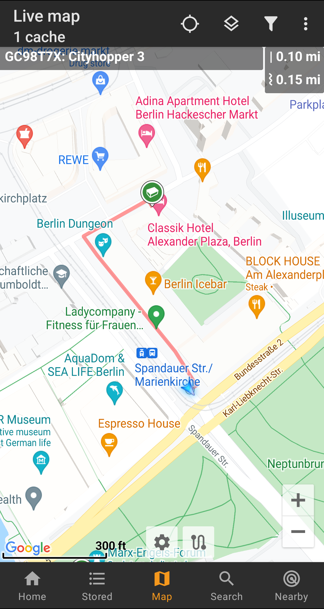
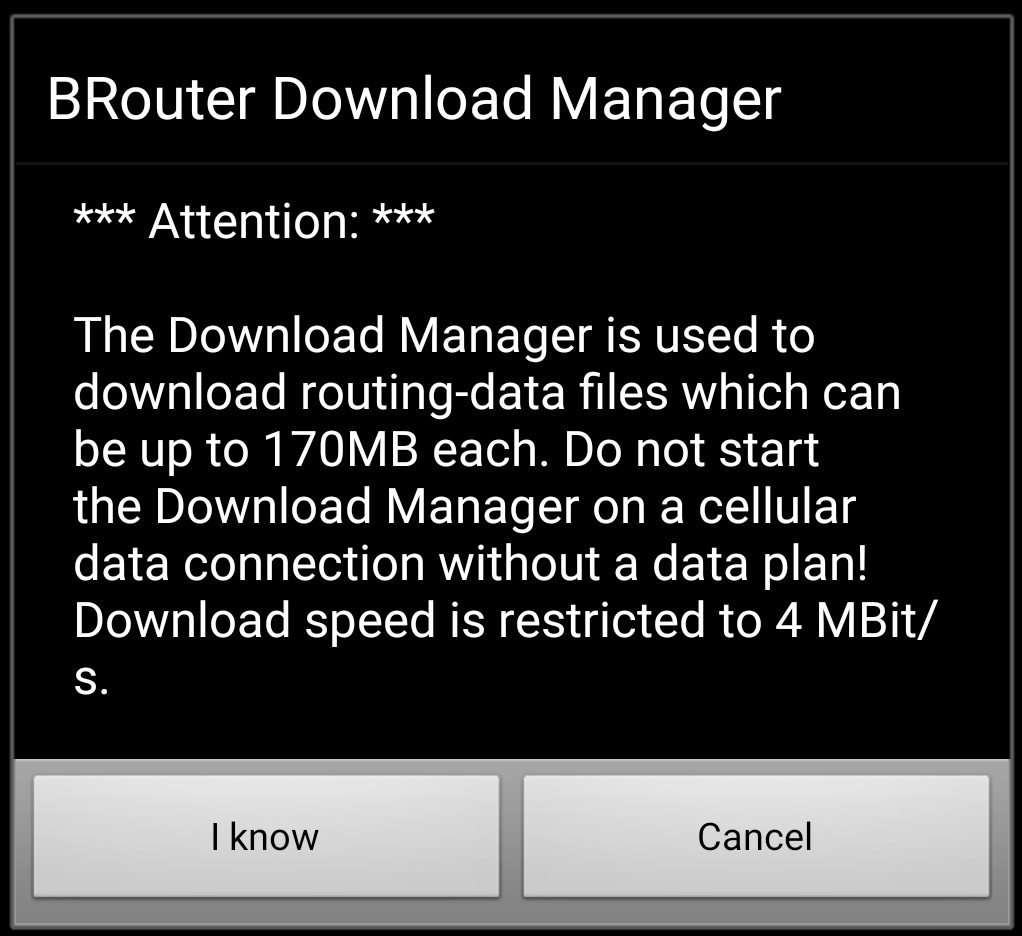
In order to download the needed routing information, start the BRouter app and select Download Manager as shown below. The Brouter App function is not needed for c:geo.
BRouter will inform you, that it needs to download a larger amount of data (depending on the size of the geographical area for which you want to download routing information). Make sure you do not use a metered network or have enough quota before you continue by selecting I know.
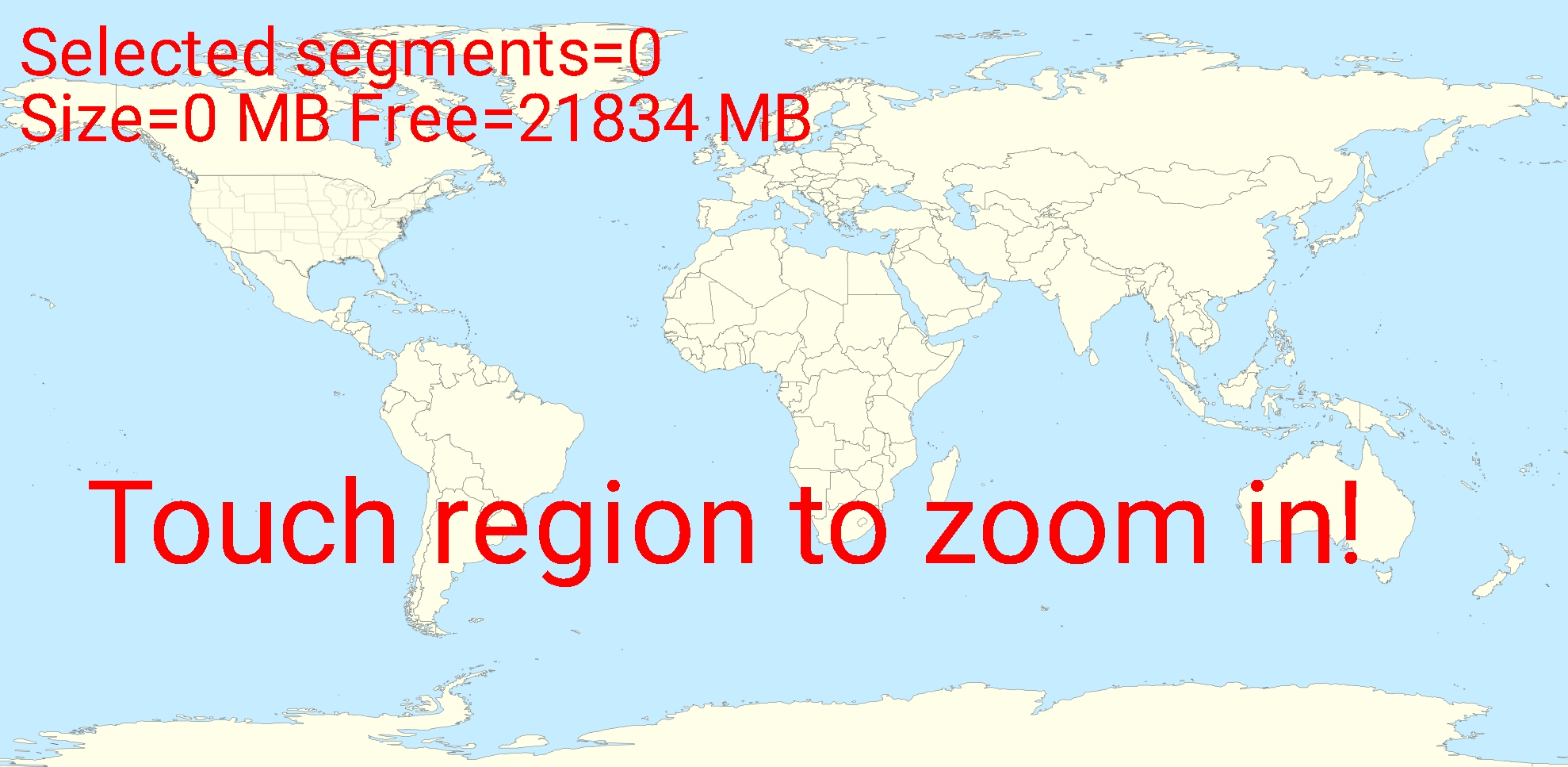
Brouter will now show a world map and you have to touch on the area, for which you want to download routing information, to zoom in and see the grid of the available routing information tiles.
Once you zoomed in you can select the tiles (will be marked in green) of the desired geographical area(s) and select Start Download to trigger the download of routing information for this area.
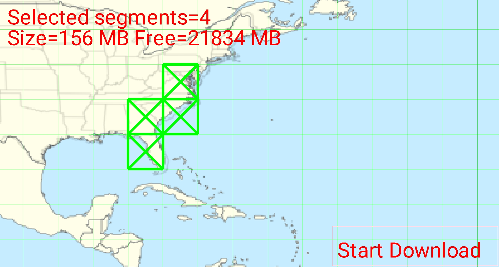
The download speed is limited by BRouter to 4 Mbit/s. So depending on the amount of routing tiles you selected the download will last a bit. Make sure to keep BRouter open in foreground while the download is in progress.
After successful download the tile map will now show the downloaded tiles in blue.

You are now good to go, but remember, that you need to download new tiles here if you want to use the navigation feature in other geographical areas as those you just downloaded. You might also want to update the existing routing info from time to time be downloading the needed tiles again with this download manager.
Once you installed and configured BRouter as described above, c:geo will use it automatically. There is no need for any configuration in c:geo, except that you might want to change the used routing mode (Bike, Walk, Car) according to your needs. You can do this in the map quick settings.
BRouter will be used to calculate routes for mainly two functions as described briefly below. You can find a complete description of the map navigation lines and their functions in the live map description of this user guide.
If you invoke navigation to a cache/waypoint using the map, the direction line between your position and the cache/waypoint will now use a routed line instead of a straight line.
The distance information on the top right will show the routed distance additionally to the straight line distance.
To make use of the individual route feature you need to enable the long click function on the map in your map behavior settings.
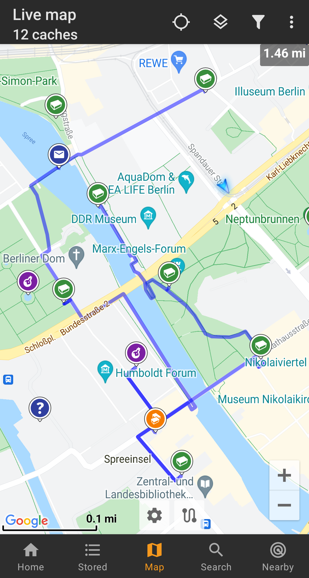
Then you can simply long click sequentially on different caches/waypoints on your map to connect them with a routed line one after another. This function e.g. allows planning of your caching trip as shown in the example below.
To remove one cache/waypoint from your route simply long click it again. Furthermore you can use the sub menu Individual route on your map menu to sort, export, import or clear your individual route.
To minimize potential delays in usage of c:geo BRouter will calculate routes up to a max. length of 10km by default. You can customize this limit between 0 an 999km in the c:geo map content settings. Furthermore you can customize the parameters (thickness, color and opaqueness) of the different lines shown on the map in the map line customization settings.
