Go to menu
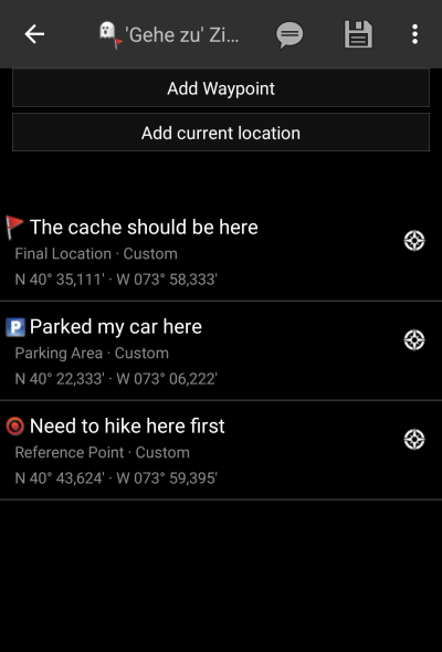
The “Go to…” menu can be used to navigate to arbitrary coordinates not bound to any geocache or geocache waypoint or to make a waypoint projection.
Technically the “Go To…” menu brings you to the waypoint tab of a c:geo internal cache. So the usage is exactly the same like for waypoints of every other cache in c:geo. Please refer to the waypoint tab and waypoint editor description on the linked page.
How to perform a waypoint projection
- Tap on “Add waypoint”
- Tap on the coordinate field and enter the coordinates where the projection shall be based upon. You can also tap on “My coordinates” to set the current position as starting point.
- Close the coordinate input and enter distance and bearing in the corresponding fields
- Save the waypoint
- Use the “compass rose” icon next to the waypoint to start the prefered navigation to this waypoint. Alternatively long tap on the waypoint and select “Navigate” to invoke other navigation methods (such as opening map or starting turn-by-turn navigation).
